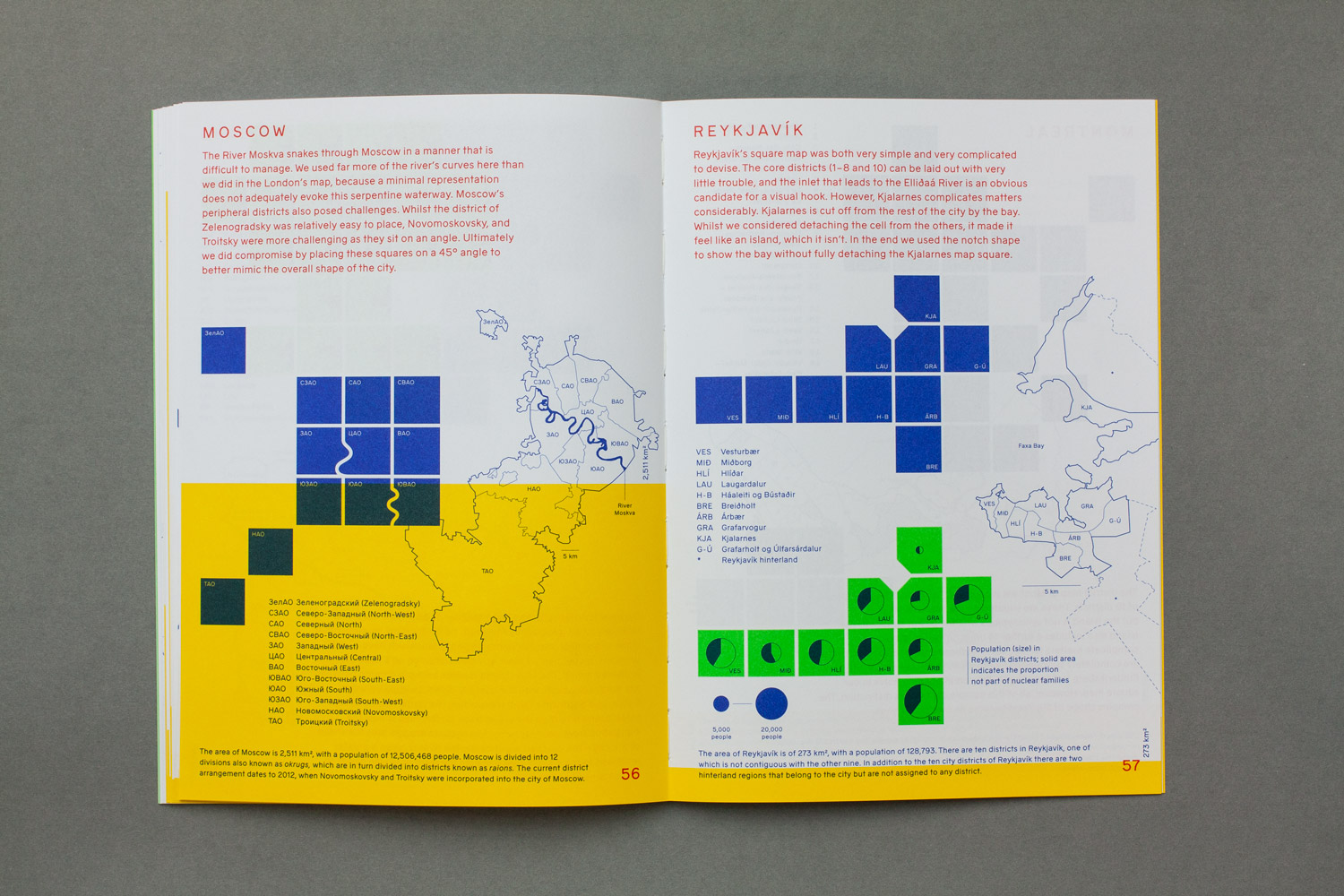
Why another map? What is the relationship between geography and useful knowledge about urban spaces? Cities Squared documents an investigation into alternate mapping methods for plotting data about cities without scale or shape influencing how that data is read.
The mapping system used here (equal-area cartograms) makes it easy to create glanceable representations of urban space, onto which a variety of data types can be plotted.
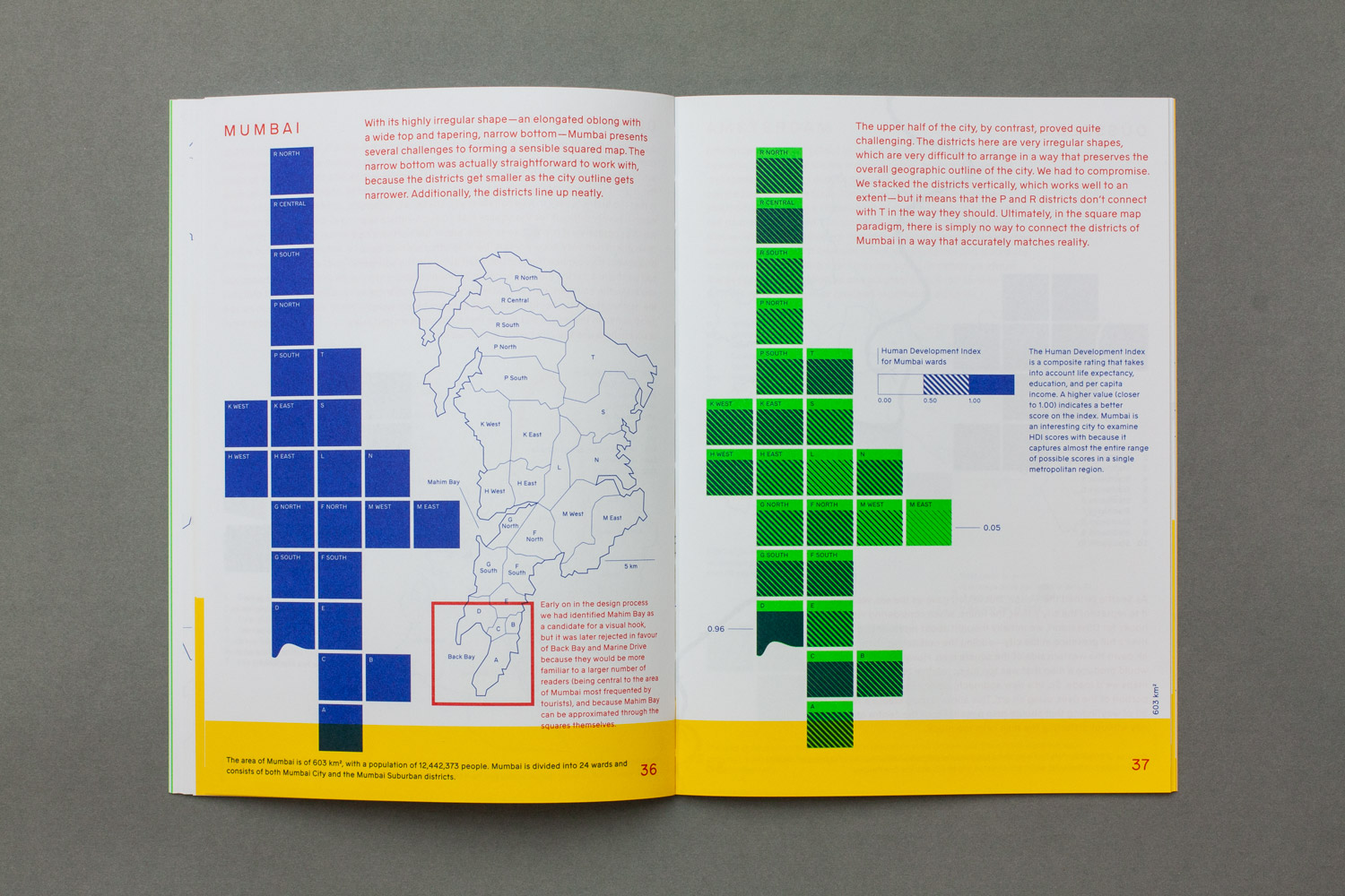
We explored cities from all over the world, including London, Helsinki, Cape Town, and Seoul, to create a set of maps that illustrate the method.
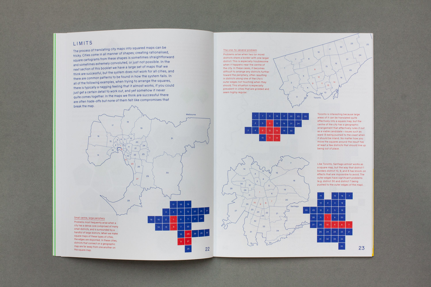
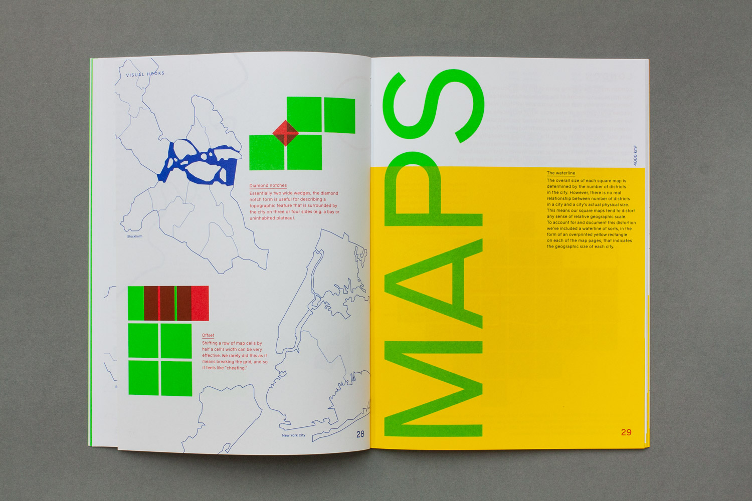
Beyond the finished maps, the book also documents the theory and process of making them, illustrating both the keys to making a successful square map and the limitations of the method.
- For more, Dan Hill expands on the introduction he wrote for the book, writing about “the broader context of data about cities, models of cities, and understanding and visualising cities”.
- Additionally, the code for generating the London maps is on Github, and can be adapted to work with other cities.